
Gelsenkirchen
Unnamed Road, 45884 Gelsenkirchen-Süd, Deutschland
Nature Reserve Mechtenberg | Hiking & Maps
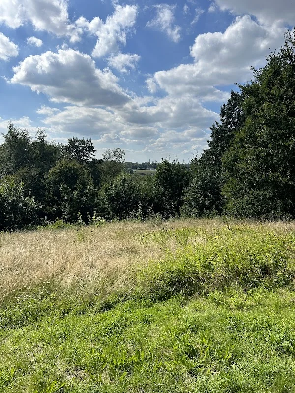
The Nature Reserve Mechtenberg is one of those places in the Ruhr area where nature, landscape history, and local recreation come together seamlessly. Located in the south of Gelsenkirchen, on the border with Essen and not far from Bochum, lies a comparatively small but very structurally rich protected area that fits into the larger landscape park Mechtenberg/Rheinelbe. Officially, the NSG covers around 13 hectares; at the same time, it is part of a significantly larger recreational area that extends across several cities and has been deliberately developed as a landscape and leisure area since the 1990s. Visitors to Mechtenberg do not encounter an urban park with a classic promenade, but an open cultural landscape with meadows, fallow land, wetlands, small bodies of water, orchards, and paths that make the area accessible for walks, short hikes, and bike tours. It is precisely this combination of tranquility, expansiveness, and astonishing diversity that makes the place appealing. At the same time, the area is closely linked to the industrial and transport history of the Ruhr area, as railway tracks, bridges, spoil heaps, and agriculturally shaped areas lie closely together around Mechtenberg. ([nsg.naturschutzinformationen.nrw.de](https://nsg.naturschutzinformationen.nrw.de/nsg/de/fachinfo/gebiete/gesamt/GE_017))
Hiking Mechtenberg: Paths, Tranquility, and Nature Experience
Those looking to hike in Mechtenberg will find primarily a terrain that is very suitable for quiet, nature-close paths. The NRW specialist dataset explicitly describes the area as a nature experience area that can be explored via several paths. The RVR adds that the landscape park offers comfortable paths for walking and cycling and that the hilly landscape is accessible through numerous paths that lead through fields and biotopes. This is the special character of Mechtenberg: One does not move through a narrow network of paths in an artificially shaped park, but through a landscape where agriculture, nature development, and leisure use coexist. Depending on the season, the impression changes noticeably, as the park presents new aspects with rapeseed bloom in spring, fruit blossom in May, grasses, wildflowers, and insects in summer, as well as open views in the cooler season. This seasonal variety is one of the reasons why Mechtenberg is particularly popular for walks and short hikes. ([nsg.naturschutzinformationen.nrw.de](https://nsg.naturschutzinformationen.nrw.de/nsg/de/fachinfo/gebiete/gesamt/GE_017))
Practically speaking: The park is freely accessible, and the paths are mostly rollable. This makes it interesting not only for hikers but also for people with strollers, wheelchairs, or bicycles, even if some sections are more challenging. The RVR points out that there is a steep ascent over cobblestones to the Bismarck Tower and that there is a noticeable incline leading to the Heaven Staircase. Therefore, those who want to hike Mechtenberg should expect a leisurely walk rather than an alpine tour. However, this is precisely the appeal: short distances, much variety, and repeated views of meadows, trees, fallow land, and the surrounding landscape. It is particularly nice that the paths not only lead through Mechtenberg itself but also create connections to other destinations. A loop can be planned that connects the landscape park Mechtenberg, the spoil heap Rheinelbe, and other green axes in the south. Those who prefer silence should come early in the morning or during the week; those who want to experience the area as a destination will also find enough space for a relaxed stay on weekends. ([rvr.ruhr](https://www.rvr.ruhr/themen/oekologie-umwelt/startseite-emscher-landschaftspark/mechtenberg-halde-rheinelbe/))
Landscape Park Mechtenberg: History and Transformation
The history of Mechtenberg is remarkably long and multifaceted. The city of Gelsenkirchen describes the hill as an ice age gravel mountain, whose river gravel indicates that the Ruhr flowed about 50 meters higher than today before the ice age. At the same time, Mechtenberg is a historical site: Finds from the Mesolithic suggest that humans have been present there at least temporarily for about 7000 years. The name of the elevation could derive from the term for a mighty mountain. In the 19th century, the idea of a Bismarck Tower was conceived at the summit; in 1899, friends and admirers of Otto von Bismarck, led by Emil Kirdorf, came together to erect such a tower. The landscape visible today is therefore not simply a natural area but the result of centuries of human use, interpretation, and transformation. The hill itself remains a prominent point that shows how closely natural formation and regional memory culture are connected. ([gelsenkirchen.de](https://www.gelsenkirchen.de/de/Stadtprofil/Stadtgeschichten/Erinnerungsorte/_Landschaftspark_Mechtenberg.aspx))
The actual development of the landscape park began in more recent times. In the early 1990s, the Regional Association of Ruhr and the neighboring cities began developing the open space as a settlement-close recreational area. As part of the International Building Exhibition Emscher Park, around 290 hectares surrounding Mechtenberg were transformed into a landscape park by 1999 in the triangle of cities Essen, Gelsenkirchen, and Bochum. The RVR emphasizes the guiding idea of connecting agriculture and industrial wasteland, nature and art, beauty with utility. From this perspective, Mechtenberg is a typical yet special Ruhr area project: not a return to an allegedly untouched nature, but the conscious design of a cultural landscape where biotopes, orchards, footpaths, bike paths, and artistic elements interact. For visitors, this means: The place offers not only tranquility but also a comprehensible history of structural change that remains visible in the terrain. ([gelsenkirchen.de](https://www.gelsenkirchen.de/de/Stadtprofil/Stadtgeschichten/Erinnerungsorte/_Landschaftspark_Mechtenberg.aspx))
Mechtenberg Height: Hills, Geology, and Views
Those searching for Mechtenberg Height usually mean the prominent elevation in the south of Gelsenkirchen. The city states that Mechtenberg is 84 meters high, while the RVR describes it as a natural elevation of around 80 meters in the triangle of Gelsenkirchen, Essen, and Bochum. For Ruhr area conditions, this is significant, as real mountains are rare here. This is precisely why Mechtenberg has a special effect: It is not just a hill but a point of orientation, a viewpoint, and a landscape counterpart to the flat and heavily used areas around it. Geologically, it is interesting because it was formed as an ice age gravel mountain. The deposited river gravel points to an older Ruhr landscape that differs significantly from the present one. The city even mentions that the summit was originally about 99 meters high but has subsided due to mining subsidence. These details make it clear that Mechtenberg is not static but is part of a long history of earth and use. ([gelsenkirchen.de](https://www.gelsenkirchen.de/de/Stadtprofil/Stadtgeschichten/Erinnerungsorte/_Landschaftspark_Mechtenberg.aspx))
However, height is not just about the number but also the impression on site. A Bismarck column has stood at the summit since 1900, giving the hill a historical landmark. At the same time, the surroundings ensure that Mechtenberg acts as a point of tranquility in the bustling urban space. The RVR describes the area as an air exchange space and a cold air generation area; this indicates that the open landscape is not only beautiful but also climatically significant. The mix of fields, orchards, avenues, small woods, and fallow land creates a changing image that is particularly noticeable throughout the year. In April, the rapeseed bloom dominates, in May the fruit bloom, followed by grain fields, wildflowers, and tall grasses. Therefore, those who understand Mechtenberg only as a viewpoint overlook its actual quality: It is a dynamically scenic place where height, use, and protection intertwine. This makes it particularly suitable for short breaks, quiet photo walks, and observations of light, weather, and vegetation. ([rvr.ruhr](https://www.rvr.ruhr/themen/oekologie-umwelt/startseite-emscher-landschaftspark/mechtenberg-halde-rheinelbe/))
Mechtenberg Maps, Access, and Entrances
Many visitors searching for Mechtenberg Maps are looking for the best access or a site plan for the circular route. Officially, the RVR provides clear guidance on this: The journey by bike is via radrevier.ruhr, junction 49; by bus and train, it is from Gelsenkirchen Hbf with bus 389 to the Nattmannsweg stop; by car, access is via the A40 Essen/Dortmund, exit Gelsenkirchen, continuing via Hattinger Straße or B227 towards the city center. Additionally, the RVR names several entrances to the park, including Am Mechtenberg in Essen as well as Hattinger Straße and Nattmannsweg in Gelsenkirchen, and Krayer Straße and Steeler Straße in Bochum. These details clearly show that the landscape park is not only accessible from one side but is reachable across cities. For good orientation, this is particularly helpful because one can plan the tour differently depending on the starting point, allowing for both short walks and longer connections into the park. ([rvr.ruhr](https://www.rvr.ruhr/themen/oekologie-umwelt/startseite-emscher-landschaftspark/mechtenberg-halde-rheinelbe/))
Additionally, there is a map in the park showing the locations of the lure posts, i.e., the steles with portraits of people who visit the landscape park for various reasons. This may initially seem like a detail, but it is useful for orientation and understanding the place because it makes the park visible not only as a natural area but also as a social space. The RVR emphasizes that Mechtenberg offers people in the Ruhr metropolis recreational opportunities right in the urban area. Those exploring the area on foot should take the topography into account: While the paths are mostly rollable, some passages are significantly steeper, especially to the Bismarck Tower and the Heaven Staircase. For cyclists, the connection via the regional junction and the railway paths is a real advantage. Thus, Mechtenberg Maps ultimately represent more than just a search query: it is the entry into a well-connected landscape space that can be flexibly explored, and where the right route strongly depends on whether one is looking for nature, views, bike paths, or connections to Rheinelbe. ([rvr.ruhr](https://www.rvr.ruhr/themen/oekologie-umwelt/startseite-emscher-landschaftspark/mechtenberg-halde-rheinelbe/))
Mechtenberg Rheinelbe: Bridge, Bike Paths, and Excursion Destinations
The name Mechtenberg is almost always thought of together with Rheinelbe, and for good reason. The landscape park Mechtenberg/Halde Rheinelbe connects two very different but closely linked landscape parts. The RVR describes the Rheinelbe spoil heap with the Heaven Staircase, the Rheinelbe forest station, and the farm at Mechtenberg as visitor magnets. Particularly striking is the Mechtenberg Bridge by Frei Otto, which is a delicate steel bridge crossing federal highway 227 and connecting the two areas of the park. The city of Gelsenkirchen also emphasizes the organic architecture of these bridges over Schwarz- and Leithebach as well as over Hattinger Straße. This makes the visit exciting because one does not just walk through a natural area but experiences a whole chain of transitions: from the field into the hilly landscape area, from there to the spoil heap, then further to the sculpture forest, Heaven Staircase, and industrially shaped sightlines. The landscape park is thus a good example of how the Ruhr area makes landscape visible not as hidden but as designed space. ([rvr.ruhr](https://www.rvr.ruhr/themen/oekologie-umwelt/startseite-emscher-landschaftspark/mechtenberg-halde-rheinelbe/))
The connection with Rheinelbe is also important for cyclists. The RVR names the Kray-Wanner-Bahn as a regional bike route that connects to the sculpture forest Rheinelbe and the Rheinelbe spoil heap. The city of Gelsenkirchen additionally points out that the landscape park Mechtenberg is connected to the regional bike network and appears in cross-city tours. Therefore, anyone planning an excursion cannot think of Mechtenberg in isolation but as part of a longer route through the southern Ruhr area. This also fits with the farm at Mechtenberg, which according to the RVR is easily accessible by bike and offers coffee, homemade cake, and a petting zoo. Such offerings make the area attractive for families, cycling groups, and relaxed day trips without losing its nature-close character. Mechtenberg is therefore not only a hiking destination but a hub between nature, agriculture, art, and movement. It is precisely in this mix that its special appeal lies, as few other places in Gelsenkirchen connect landscape and structural change so directly. ([rvr.ruhr](https://www.rvr.ruhr/themen/oekologie-umwelt/startseite-emscher-landschaftspark/mechtenberg-halde-rheinelbe/))
Nature Reserve Mechtenberg: Species, Biotopes, and Consideration
The Nature Reserve Mechtenberg is particularly valuable because it combines an extraordinary variety of habitats in a small space. The state dataset describes a structural richness with old embankment areas, grass and tall herb-rich fallow fields, wet grassland fallows, reed beds, small bodies of water, and a southern wet area with larger and smaller near-natural still waters. Additionally, there are orchards, bushes, and young willow succession forests. This mix is not only visually interesting but also ecologically significant: Numerous species of grasshoppers have been documented in the area, and it is also a valuable habitat for endangered plant and breeding bird species as well as amphibians. The waters exhibit a pronounced zonation with small and large reed beds, sedge belts, as well as floating leaf and underwater vegetation. For visitors, this means: It is worth taking a close look here. Those who walk slowly will discover different plants, sounds, and animal observations depending on the season. ([nsg.naturschutzinformationen.nrw.de](https://nsg.naturschutzinformationen.nrw.de/nsg/de/fachinfo/gebiete/gesamt/GE_017))
From these conservation goals, a clear stance for visiting emerges: The area is not a decorative city park but a sensitive natural area that needs tranquility and consideration. Officially, NRW specialist information names the safeguarding of the area as a resting and breeding place for meadow and wading birds as well as a land habitat and spawning ground for amphibians. This is a good indication that visitors should stay on the paths and avoid disturbances as much as possible. At the same time, this protective function makes Mechtenberg so interesting because one can see how nature conservation looks in the Ruhr area: not as a separation from the city, but as a designed open space in the midst of a densely populated area. The landscape park also supports the local climate, as the RVR describes it as an air exchange space and cold air generation area. Therefore, those who visit Mechtenberg responsibly not only experience beautiful views but also understand why such areas are important for the urban region. Nature experience, species diversity, and recreation are not opposites here but together form the quality of the place. ([nsg.naturschutzinformationen.nrw.de](https://nsg.naturschutzinformationen.nrw.de/nsg/de/fachinfo/gebiete/gesamt/GE_017))
Sources:
Show moreShow less
Nature Reserve Mechtenberg | Hiking & Maps
The Nature Reserve Mechtenberg is one of those places in the Ruhr area where nature, landscape history, and local recreation come together seamlessly. Located in the south of Gelsenkirchen, on the border with Essen and not far from Bochum, lies a comparatively small but very structurally rich protected area that fits into the larger landscape park Mechtenberg/Rheinelbe. Officially, the NSG covers around 13 hectares; at the same time, it is part of a significantly larger recreational area that extends across several cities and has been deliberately developed as a landscape and leisure area since the 1990s. Visitors to Mechtenberg do not encounter an urban park with a classic promenade, but an open cultural landscape with meadows, fallow land, wetlands, small bodies of water, orchards, and paths that make the area accessible for walks, short hikes, and bike tours. It is precisely this combination of tranquility, expansiveness, and astonishing diversity that makes the place appealing. At the same time, the area is closely linked to the industrial and transport history of the Ruhr area, as railway tracks, bridges, spoil heaps, and agriculturally shaped areas lie closely together around Mechtenberg. ([nsg.naturschutzinformationen.nrw.de](https://nsg.naturschutzinformationen.nrw.de/nsg/de/fachinfo/gebiete/gesamt/GE_017))
Hiking Mechtenberg: Paths, Tranquility, and Nature Experience
Those looking to hike in Mechtenberg will find primarily a terrain that is very suitable for quiet, nature-close paths. The NRW specialist dataset explicitly describes the area as a nature experience area that can be explored via several paths. The RVR adds that the landscape park offers comfortable paths for walking and cycling and that the hilly landscape is accessible through numerous paths that lead through fields and biotopes. This is the special character of Mechtenberg: One does not move through a narrow network of paths in an artificially shaped park, but through a landscape where agriculture, nature development, and leisure use coexist. Depending on the season, the impression changes noticeably, as the park presents new aspects with rapeseed bloom in spring, fruit blossom in May, grasses, wildflowers, and insects in summer, as well as open views in the cooler season. This seasonal variety is one of the reasons why Mechtenberg is particularly popular for walks and short hikes. ([nsg.naturschutzinformationen.nrw.de](https://nsg.naturschutzinformationen.nrw.de/nsg/de/fachinfo/gebiete/gesamt/GE_017))
Practically speaking: The park is freely accessible, and the paths are mostly rollable. This makes it interesting not only for hikers but also for people with strollers, wheelchairs, or bicycles, even if some sections are more challenging. The RVR points out that there is a steep ascent over cobblestones to the Bismarck Tower and that there is a noticeable incline leading to the Heaven Staircase. Therefore, those who want to hike Mechtenberg should expect a leisurely walk rather than an alpine tour. However, this is precisely the appeal: short distances, much variety, and repeated views of meadows, trees, fallow land, and the surrounding landscape. It is particularly nice that the paths not only lead through Mechtenberg itself but also create connections to other destinations. A loop can be planned that connects the landscape park Mechtenberg, the spoil heap Rheinelbe, and other green axes in the south. Those who prefer silence should come early in the morning or during the week; those who want to experience the area as a destination will also find enough space for a relaxed stay on weekends. ([rvr.ruhr](https://www.rvr.ruhr/themen/oekologie-umwelt/startseite-emscher-landschaftspark/mechtenberg-halde-rheinelbe/))
Landscape Park Mechtenberg: History and Transformation
The history of Mechtenberg is remarkably long and multifaceted. The city of Gelsenkirchen describes the hill as an ice age gravel mountain, whose river gravel indicates that the Ruhr flowed about 50 meters higher than today before the ice age. At the same time, Mechtenberg is a historical site: Finds from the Mesolithic suggest that humans have been present there at least temporarily for about 7000 years. The name of the elevation could derive from the term for a mighty mountain. In the 19th century, the idea of a Bismarck Tower was conceived at the summit; in 1899, friends and admirers of Otto von Bismarck, led by Emil Kirdorf, came together to erect such a tower. The landscape visible today is therefore not simply a natural area but the result of centuries of human use, interpretation, and transformation. The hill itself remains a prominent point that shows how closely natural formation and regional memory culture are connected. ([gelsenkirchen.de](https://www.gelsenkirchen.de/de/Stadtprofil/Stadtgeschichten/Erinnerungsorte/_Landschaftspark_Mechtenberg.aspx))
The actual development of the landscape park began in more recent times. In the early 1990s, the Regional Association of Ruhr and the neighboring cities began developing the open space as a settlement-close recreational area. As part of the International Building Exhibition Emscher Park, around 290 hectares surrounding Mechtenberg were transformed into a landscape park by 1999 in the triangle of cities Essen, Gelsenkirchen, and Bochum. The RVR emphasizes the guiding idea of connecting agriculture and industrial wasteland, nature and art, beauty with utility. From this perspective, Mechtenberg is a typical yet special Ruhr area project: not a return to an allegedly untouched nature, but the conscious design of a cultural landscape where biotopes, orchards, footpaths, bike paths, and artistic elements interact. For visitors, this means: The place offers not only tranquility but also a comprehensible history of structural change that remains visible in the terrain. ([gelsenkirchen.de](https://www.gelsenkirchen.de/de/Stadtprofil/Stadtgeschichten/Erinnerungsorte/_Landschaftspark_Mechtenberg.aspx))
Mechtenberg Height: Hills, Geology, and Views
Those searching for Mechtenberg Height usually mean the prominent elevation in the south of Gelsenkirchen. The city states that Mechtenberg is 84 meters high, while the RVR describes it as a natural elevation of around 80 meters in the triangle of Gelsenkirchen, Essen, and Bochum. For Ruhr area conditions, this is significant, as real mountains are rare here. This is precisely why Mechtenberg has a special effect: It is not just a hill but a point of orientation, a viewpoint, and a landscape counterpart to the flat and heavily used areas around it. Geologically, it is interesting because it was formed as an ice age gravel mountain. The deposited river gravel points to an older Ruhr landscape that differs significantly from the present one. The city even mentions that the summit was originally about 99 meters high but has subsided due to mining subsidence. These details make it clear that Mechtenberg is not static but is part of a long history of earth and use. ([gelsenkirchen.de](https://www.gelsenkirchen.de/de/Stadtprofil/Stadtgeschichten/Erinnerungsorte/_Landschaftspark_Mechtenberg.aspx))
However, height is not just about the number but also the impression on site. A Bismarck column has stood at the summit since 1900, giving the hill a historical landmark. At the same time, the surroundings ensure that Mechtenberg acts as a point of tranquility in the bustling urban space. The RVR describes the area as an air exchange space and a cold air generation area; this indicates that the open landscape is not only beautiful but also climatically significant. The mix of fields, orchards, avenues, small woods, and fallow land creates a changing image that is particularly noticeable throughout the year. In April, the rapeseed bloom dominates, in May the fruit bloom, followed by grain fields, wildflowers, and tall grasses. Therefore, those who understand Mechtenberg only as a viewpoint overlook its actual quality: It is a dynamically scenic place where height, use, and protection intertwine. This makes it particularly suitable for short breaks, quiet photo walks, and observations of light, weather, and vegetation. ([rvr.ruhr](https://www.rvr.ruhr/themen/oekologie-umwelt/startseite-emscher-landschaftspark/mechtenberg-halde-rheinelbe/))
Mechtenberg Maps, Access, and Entrances
Many visitors searching for Mechtenberg Maps are looking for the best access or a site plan for the circular route. Officially, the RVR provides clear guidance on this: The journey by bike is via radrevier.ruhr, junction 49; by bus and train, it is from Gelsenkirchen Hbf with bus 389 to the Nattmannsweg stop; by car, access is via the A40 Essen/Dortmund, exit Gelsenkirchen, continuing via Hattinger Straße or B227 towards the city center. Additionally, the RVR names several entrances to the park, including Am Mechtenberg in Essen as well as Hattinger Straße and Nattmannsweg in Gelsenkirchen, and Krayer Straße and Steeler Straße in Bochum. These details clearly show that the landscape park is not only accessible from one side but is reachable across cities. For good orientation, this is particularly helpful because one can plan the tour differently depending on the starting point, allowing for both short walks and longer connections into the park. ([rvr.ruhr](https://www.rvr.ruhr/themen/oekologie-umwelt/startseite-emscher-landschaftspark/mechtenberg-halde-rheinelbe/))
Additionally, there is a map in the park showing the locations of the lure posts, i.e., the steles with portraits of people who visit the landscape park for various reasons. This may initially seem like a detail, but it is useful for orientation and understanding the place because it makes the park visible not only as a natural area but also as a social space. The RVR emphasizes that Mechtenberg offers people in the Ruhr metropolis recreational opportunities right in the urban area. Those exploring the area on foot should take the topography into account: While the paths are mostly rollable, some passages are significantly steeper, especially to the Bismarck Tower and the Heaven Staircase. For cyclists, the connection via the regional junction and the railway paths is a real advantage. Thus, Mechtenberg Maps ultimately represent more than just a search query: it is the entry into a well-connected landscape space that can be flexibly explored, and where the right route strongly depends on whether one is looking for nature, views, bike paths, or connections to Rheinelbe. ([rvr.ruhr](https://www.rvr.ruhr/themen/oekologie-umwelt/startseite-emscher-landschaftspark/mechtenberg-halde-rheinelbe/))
Mechtenberg Rheinelbe: Bridge, Bike Paths, and Excursion Destinations
The name Mechtenberg is almost always thought of together with Rheinelbe, and for good reason. The landscape park Mechtenberg/Halde Rheinelbe connects two very different but closely linked landscape parts. The RVR describes the Rheinelbe spoil heap with the Heaven Staircase, the Rheinelbe forest station, and the farm at Mechtenberg as visitor magnets. Particularly striking is the Mechtenberg Bridge by Frei Otto, which is a delicate steel bridge crossing federal highway 227 and connecting the two areas of the park. The city of Gelsenkirchen also emphasizes the organic architecture of these bridges over Schwarz- and Leithebach as well as over Hattinger Straße. This makes the visit exciting because one does not just walk through a natural area but experiences a whole chain of transitions: from the field into the hilly landscape area, from there to the spoil heap, then further to the sculpture forest, Heaven Staircase, and industrially shaped sightlines. The landscape park is thus a good example of how the Ruhr area makes landscape visible not as hidden but as designed space. ([rvr.ruhr](https://www.rvr.ruhr/themen/oekologie-umwelt/startseite-emscher-landschaftspark/mechtenberg-halde-rheinelbe/))
The connection with Rheinelbe is also important for cyclists. The RVR names the Kray-Wanner-Bahn as a regional bike route that connects to the sculpture forest Rheinelbe and the Rheinelbe spoil heap. The city of Gelsenkirchen additionally points out that the landscape park Mechtenberg is connected to the regional bike network and appears in cross-city tours. Therefore, anyone planning an excursion cannot think of Mechtenberg in isolation but as part of a longer route through the southern Ruhr area. This also fits with the farm at Mechtenberg, which according to the RVR is easily accessible by bike and offers coffee, homemade cake, and a petting zoo. Such offerings make the area attractive for families, cycling groups, and relaxed day trips without losing its nature-close character. Mechtenberg is therefore not only a hiking destination but a hub between nature, agriculture, art, and movement. It is precisely in this mix that its special appeal lies, as few other places in Gelsenkirchen connect landscape and structural change so directly. ([rvr.ruhr](https://www.rvr.ruhr/themen/oekologie-umwelt/startseite-emscher-landschaftspark/mechtenberg-halde-rheinelbe/))
Nature Reserve Mechtenberg: Species, Biotopes, and Consideration
The Nature Reserve Mechtenberg is particularly valuable because it combines an extraordinary variety of habitats in a small space. The state dataset describes a structural richness with old embankment areas, grass and tall herb-rich fallow fields, wet grassland fallows, reed beds, small bodies of water, and a southern wet area with larger and smaller near-natural still waters. Additionally, there are orchards, bushes, and young willow succession forests. This mix is not only visually interesting but also ecologically significant: Numerous species of grasshoppers have been documented in the area, and it is also a valuable habitat for endangered plant and breeding bird species as well as amphibians. The waters exhibit a pronounced zonation with small and large reed beds, sedge belts, as well as floating leaf and underwater vegetation. For visitors, this means: It is worth taking a close look here. Those who walk slowly will discover different plants, sounds, and animal observations depending on the season. ([nsg.naturschutzinformationen.nrw.de](https://nsg.naturschutzinformationen.nrw.de/nsg/de/fachinfo/gebiete/gesamt/GE_017))
From these conservation goals, a clear stance for visiting emerges: The area is not a decorative city park but a sensitive natural area that needs tranquility and consideration. Officially, NRW specialist information names the safeguarding of the area as a resting and breeding place for meadow and wading birds as well as a land habitat and spawning ground for amphibians. This is a good indication that visitors should stay on the paths and avoid disturbances as much as possible. At the same time, this protective function makes Mechtenberg so interesting because one can see how nature conservation looks in the Ruhr area: not as a separation from the city, but as a designed open space in the midst of a densely populated area. The landscape park also supports the local climate, as the RVR describes it as an air exchange space and cold air generation area. Therefore, those who visit Mechtenberg responsibly not only experience beautiful views but also understand why such areas are important for the urban region. Nature experience, species diversity, and recreation are not opposites here but together form the quality of the place. ([nsg.naturschutzinformationen.nrw.de](https://nsg.naturschutzinformationen.nrw.de/nsg/de/fachinfo/gebiete/gesamt/GE_017))
Sources:

Frequently Asked Questions
Reviews
No reviews found